Coastal stakeholders need monitoring solutions to evaluate the effectiveness of dredged material for combating sea level rise in back-bay environments. In response, EWN researchers have partnered with Syracuse University’s Civil and Environmental Engineering Department to explore the viability of employing satellite-derived data for studying back-bay sediment nourishment, linking USACE needs with NASA’s working group tasked with designing the next domestic synthetic aperture radar satellite platform.

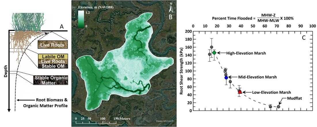
Sediment erosion, deposition, and land subsidence are key influencers of relative sea level rise, and USACE combats these challenges through beneficial use of dredged material (BUDM). Addressing the complexity of shifting coastal topography requires tailored management strategies. A lack of historical, recurring observations hampers our ability to quantify impacts, patterns, and trends in coastal change across different drivers.
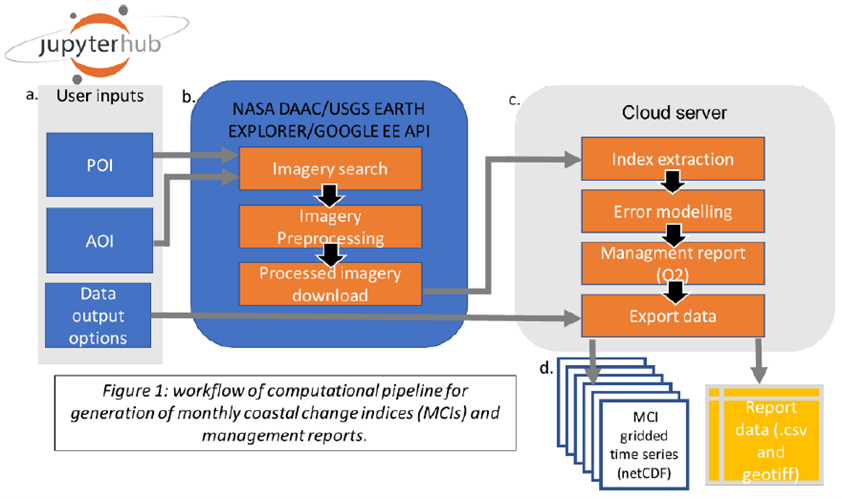
Dr. Elizabeth Carter’s team at Syracuse University will work with the Engineer Research and Development Center to develop an operational dataset of vital coastal change parameters, vertical displacement, and dynamic land-sea masks. Leveraging open-source, portable software, the team will extract information from publicly available imagery archives from multiple satellite platforms, facilitating management-relevant data summaries. This demonstration will use existing satellite data for immediate coastal monitoring needs at active BUDM sites.
Recognizing the dynamic evolution of earth observing satellites, Syracuse University will assess the potential of the current satellite fleet to meet novel monitoring demands of USACE. The results will be shared with USACE-ERDC and the NASA Surface Deformation and Change (SDC) working group, influencing the design of the next-generation synthetic aperture radar (SAR) satellite platform.


