Project Location and Background
Fifteen miles from the Chesapeake Bay located along the James River is Jamestown Island, Virginia. This 2.4 square-mile island was the site of the first permanent English settlement in North America in 1607 and is today part of Colonial National Historical Park (the park).
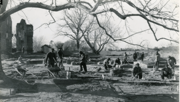
The park includes several geographically distinct locations in Jamestown, Williamsburg, and Yorktown that are connected by the Colonial Parkway. This project was focused solely on the Jamestown portion of the park. The area has a rich history of human habitation that extends from the last Ice Age through the 20th century and the island’s vast and varied resources made it an ideal location for settlement. Jamestown was frequently used by the Powhatan Tribe as a seasonal camping site and was later occupied by European settlers as a defensive location during the Revolutionary War and Civil War. Its location along the James River made it easily accessible and eventually necessitated dredging of the river to improve navigation. It was the large-scale dredging of sediment that enabled the construction of the Parkway we know today that connects Jamestown with the rest of Colonial National Historical Park. As a result of this long history of human habitation, the park contains important archeological and historic cultural resources.
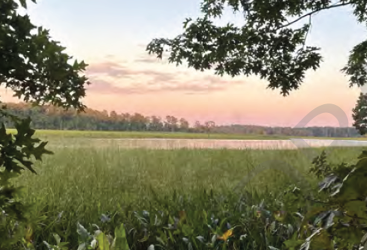
The park also supports rich natural resources. At the center of the island is a loblolly pine and oak forest surrounded by extensive tidal marshes and small creeks that weave through the landscape. The park contains unique habitats including tidal bald cypress swamps, freshwater marshes, meadows, and beaches. Diverse wetland and terrestrial ecosystems provide habitat for a variety of plant and animal species, many of which are rare, threatened, or endangered. Though climate change threatens the park as it exists today, Jamestown Island is a historically dynamic place with a deep history of connection to the water’s edge.
Challenges
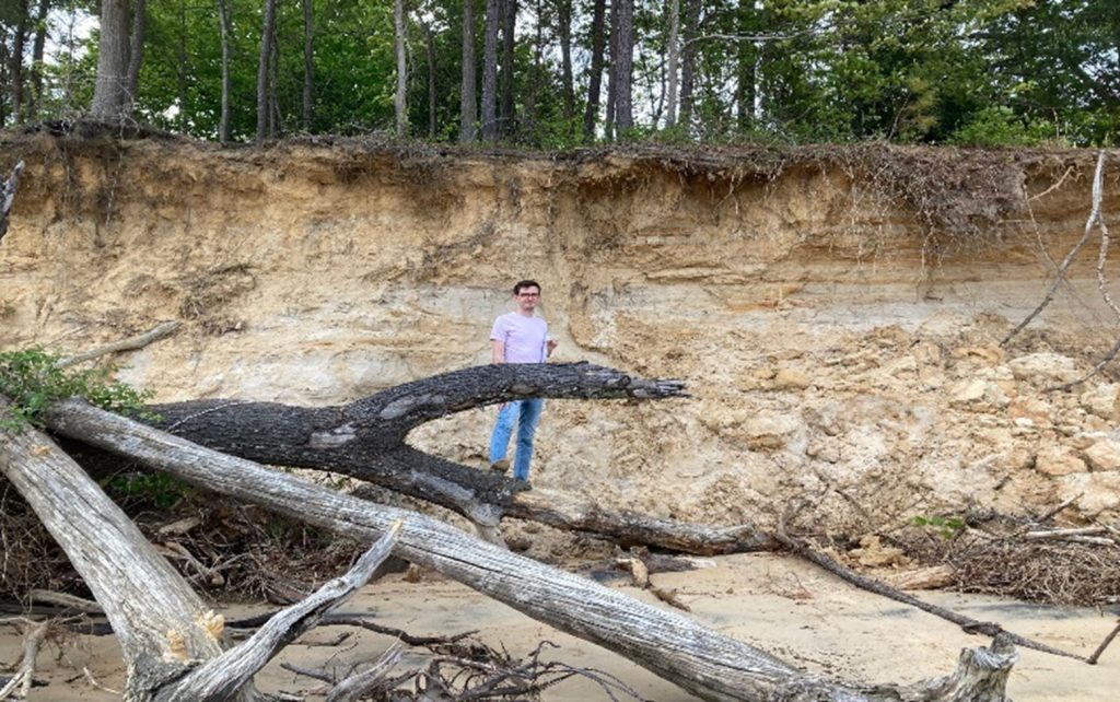
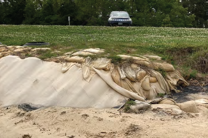
Given the park’s low-lying topography and location, the threat to Jamestown Island and all of the park is primarily from the combined effects of tides, storm surges, and sea level rise. Intense storms have caused erosion and damaged park resources in recent years including damage to shoreline stabilization structures, vital infrastructure, and archeological sites [1]. In addition, the mean sea level trends from the nearby Gloucester Point tide gauge indicate an increase of 0.15 inches/ year, more than twice the global average during that time [1]. The combined pressures of sea level rise and the increase in frequency and intensity of extreme weather events continue to put the park’s shoreline, infrastructure, ecological resources, and historical resources at risk.
Management of the Colonial National Historical Park emphasizes exploring and explaining the colonial history of the area, though this focus is expanding to a wider range of stories and values. As such, the park is the steward of important historical and cultural resources, many of which are still buried underground. Because much of the historical significance and cultural resources in the park are associated with and located along the shoreline, erosion is a critical concern.
Based on current sea level rise projections, much of Jamestown Island is expected to be underwater by 2050. The park’s cultural resources and diverse coastal and terrestrial habitats are threatened by inundation, saltwater intrusion, and increased storm surge impacts.
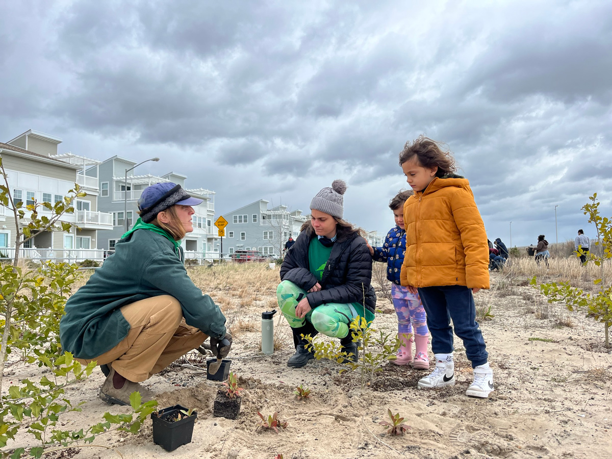
To understand these challenges and develop potential solutions, the project team conducted a research project from February 2022 to January 2023 to inform the park of natural and nature-based features (NNBF) that could be implemented to protect these resources. NNBF works with natural landforms and processes to make the system more resilient to these impacts. This approach can reduce erosive impacts, protect areas from storm surges, combat the effects of sea level rise, and are visually appealing to visitors.
Objectives
As outlined in the park’s Integrated Coastal Climate Change Vulnerability Assessment [2], the National Park Service has short-term goals to maintain access and protect historical artifacts and facilities at the park. The park’s long-term goals (50 years) are to maintain cultural landscape features, preserve habitat and increase ecological transition, and to make stronger interpretive connections to the challenges original inhabitants and colonists faced living on a marshy, tidal, flooding, and shifting coast.
The project framework bridges these goals by connecting shoreline maintenance practices to the experiences of park visitors, descendant communities, tribes with a historical presence, ecological communities, and geomorphological changes that shaped the ridges and shallows that have characterized this region for thousands of years. The team sought to understand the historical, hydrological, and ecological dynamics to design several NNBF concept designs that align with the goals, character, landscape, and integrity of the park.
Approach
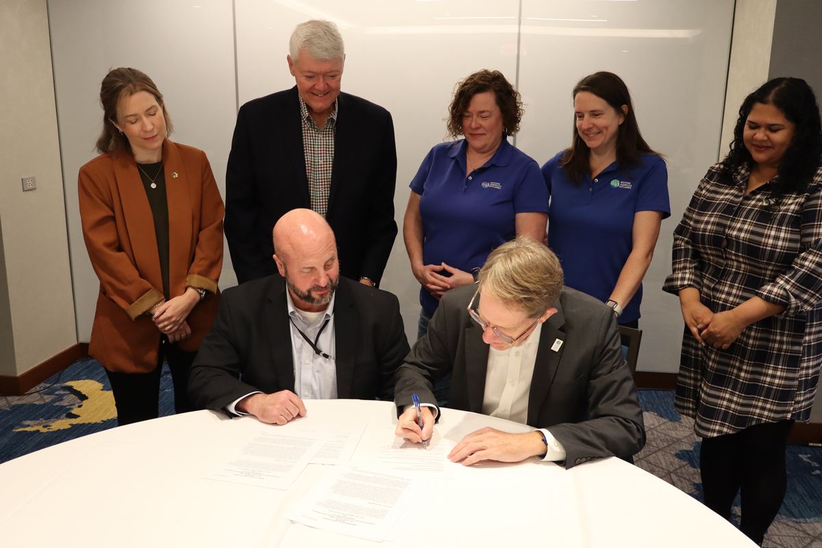
To assist the park in understanding these problems and identifying potential solutions in support of long-term goals the University of Virginia, in partnership with The Nature Conservancy, the National Park Service, and EA Engineering, Science and Technology Inc., PBC, and support from the USACE Engineering with Nature Program collaborated to generate resilient NNBF solutions based on Engineering with Nature principles. The team produced four conceptual NNBF designs that range in scope and scale to meet the challenges the park will face as climate changes. These design concepts seek to address the detrimental effects of sea level rise and erosion at Jamestown.
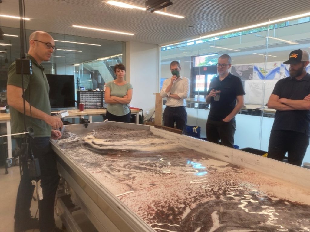
Research into the Jamestown Island site involved GIS analysis, site visits, archival research, and analysis of existing studies and practices, maintenance, and goals. The team also completed an analysis of existing information on historical resources, ecological resources, and infrastructure at the park. In May of 2022, the team collaborated with the park to tour the site and better understand the issues occurring at Jamestown. With this information, the project team identified areas for potential concept designs. These designs were further refined during a design workshop in June of 2022 held at the University of Virginia. The team presented these concepts to the park in September of 2022 and provided a detailed report of the research and designs for the park’s consideration.
This work is part of a larger three-year effort being undertaken by the team to study NNBF in Chesapeake Bay parks. The team is currently working on a similar effort at Assateague National Seashore and will be working with the Harriet Tubman Underground Railroad National Historical Park in 2024. Each of these parks presents unique challenges and opportunities for addressing coastal resilience with NNBF.
Outcomes
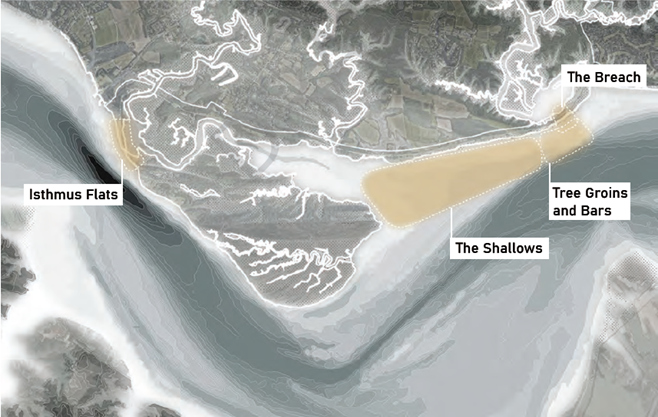
Conceptual designs for 4 areas of concern were proposed by the project team to increase coastal resiliency for the park on Jamestown Island. These conceptual designs include various approaches for different areas of concern including Tree Groins and Bars, The Shallows, The Breach, and Isthmus Flats.
The full report of the project background and proposed designs can be found here [Preserving Coastal Parklands: Colonial National Historic Parkway].
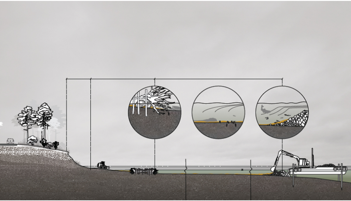
Tree Groins and Bars
The first concept includes placing tree groins and bars to provide stabilization and encourage the accretion of sediment along the shoreline. This concept integrates both onshore and nearshore shoreline protection strategies to improve the stabilization of the shoreline and increase its resiliency to sea level rise. Tree groins and nearshore bars make use of local materials and improve hydrological dynamics to provide protection along an exposed and eroded stretch of shoreline adjacent to the Colonial Parkway. Nearshore structures allow for the natural accretion of sediment which helps maintain the beach area and protect the Parkway. The structures, constructed from large tree logs, would also help dissipate wave energy from severe storms that erode the shoreline. This concept could be tested as a pilot project by utilizing resources from the ongoing tree removal operations in the park and could be accomplished with minimal additional outside funds.
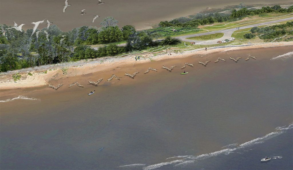
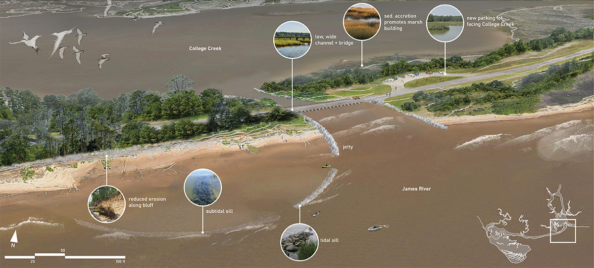
The Shallows
The area called ‘The Shallows’ includes the shallow water of the James River that runs adjacent to the Colonial National Historical Parkway and becomes the Back River. The navigational waterway in the James River is maintained by regular dredging of sediment to allow for the passage of large marine vessels. Making beneficial use of the large quantities of dredged sediment (approximately 200,000 cubic yards annually) pulled from the federal channel surrounding Jamestown Island has the potential to preserve historic processes and landscape features in the riparian and coastal zone. It is a historic process in its own right, as early dredging enabled navigation of the James river in the post-antebellum era as well as the construction of the Parkway that connects Jamestown to Williamsburg and Yorktown in the post-War era.
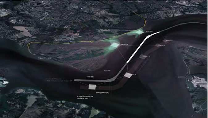
The beneficial use of large amounts of sediment is the primary means of adapting the park to sea level rise using NNBF. This proposal proposes bluff protection, parkway preservation, and wetland aggradation. Partnering with USACE to place sediment dredged from the Goose Hill channel in key areas around Jamestown Island could dampen increasingly strong hydrological forces, support native ecological communities, and enhance the visitor experience of this historical landscape. This approach would allow a practical interpretation of the technique for enabling river navigation that was fundamental to Jamestown and that has been ongoing in this location for 140 years. The strategically placed sediment would also help support the vast marsh habitat along the Jamestown Island shoreline which provides natural protection against the impacts of storms and sea level rise.
The Breach
The third concept includes protecting the wetlands complex within College Creek using a breach. The introduction of a wide, shallow breach at the location of the existing parking lot, dividing the naturally formed isthmus from the filled portion of the parkway, would restore the natural geomorphology and could enhance sediment exchange and promote marsh-building in College Creek. Allowing additional sediment to enter this large marsh complex would build natural resilience into the marshes as the sea level begins to rise.
This concept would also enable opportunities for interpreting the ingenuity and labor that was required for the original construction of the Parkway and is critical to its future viability.
The Isthmus Flats
The Isthmus Flats include the expansive marsh system between the northwestern portion of Jamestown Island and the parkway. To make the Isthmus Flats more resilient the team proposed thin layer placement (TLP), which includes applying dredge sediment in a thin layer on top of the existing marsh to increase its elevation creating a mixture of tidal marsh and tidal flat. The edges near the parkway would be built up to connect the marsh to the slopes of the roadbed and enable future marsh migration. The slopes of the cultural meadow that are currently maintained as mown grass would instead become a gradient from tidal flats to low marsh to the high marsh to woods. Finally, a boardwalk could be constructed along the line of the existing bulkhead along the isthmus to interpret that structure and bring visitors closer to the water.
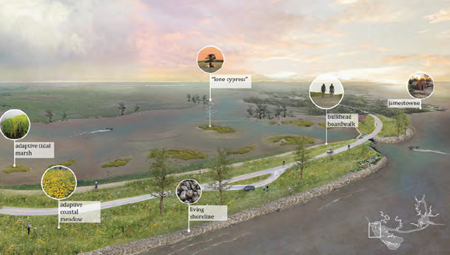
The Isthmus Flats concept would also create conditions for the cypress forest and the tidal marsh to expand and potentially keep pace with sea level rise. This would also assist in sustaining the elevation needed for the bald cypress forests to be maintained and expanded.
References
[1] Thornberry-Ehrlich, “Colonial National Historical Park Geologic Resources Inventory Report”, Natural Resource Report NPS/NRSS/GRD/NRR—2016/1237. [Online]. Available: https://irma.nps.gov/DataStore/DownloadFile/551474
[2] G. Ricci, D. Robadue, P. Rubinoff, A. Casey, and A. Babson. Integrated Coastal Climate Change Vulnerability Assessment, Colonial National Historical Park. Natural Resource Report NPS/COLO/NRR—2019/1945. [Online]. Available: https://irma.nps.gov/DataStore/DownloadFile/627300