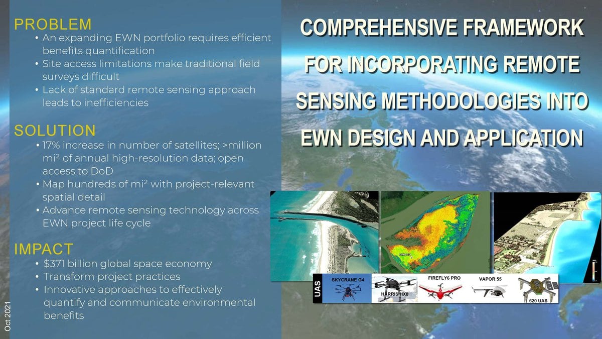
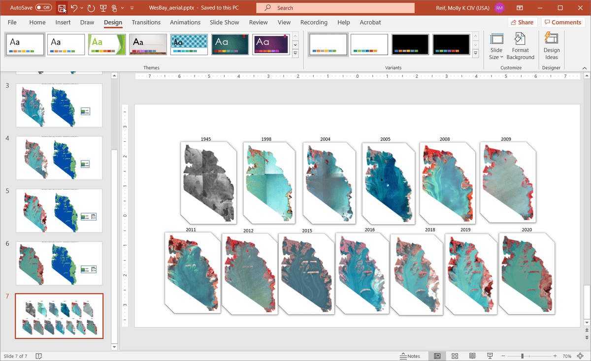
Remote sensing is a technology that allows for the observation of physical attributes of the earth using sensing devices such as cameras or infrared sensors from remote devices like satellites, drones, or aircraft. This research project will help improve the understanding and integration of remote sensing approaches to quantify environmental benefits of EWN® projects. Remote sensing approaches are expected to be instrumental in illustrating and quantifying critical EWN® concepts such as habitat developed as a result of strategically placed dredge material or integrated into engineered structures, NNBF supporting coastal resilience, ecosystem services supporting engineering function, and shoreline conditions from native plantings.
