December 3, 2024

Lidar and Multispectral Image Surveys Monitor Wetlands Elevated with Dredge Material in the Back-Bay Identifying Areas for Future Improvement

  • news

The U.S. Army Corps of Engineers Philadelphia District (USACE-NAP) is making strides in coastal resilience by collaborating with The Wetlands Institute (TWI) and New Jersey’s Department of Environmental Protection (NJDEP) to restore a degraded section of back-bay wetland at Scotch Bonnet, NJ. Using sediment dredged from the Atlantic Intracoastal Waterway (AICWW), the project seeks to elevate the marsh platform, countering rapid transitions from vegetated marsh to mudflat.

Adding to this effort, the Engineer Research and Development Center’s Coastal and Hydraulics Laboratory (ERDC-CHL), in collaboration with the University of Washington’s NSF Natural Hazards Engineering Research Infrastructure (NHERI) Reconnaissance Experimental Facility (RAPID), conducted lidar and multispectral surveys of the nourished areas. Uncrewed aerial systems (UASs) played a pivotal role in capturing high-resolution data from the site, a task otherwise challenging due to limited access during and immediately after material placement.

(Left) Initial set up and (Right) take-off of the Freefly Alta-X outfitted with the Phoenix Lidar Systems MiniRanger. From left to right are Dr. Michael Grilliot (RAPID), Dr. Brian Harris (CHL), and Andrew Lyda (RAPID). Left photo taken by Devin Griffiths (TWI).
(Left) Calibration of the multispectral camera on the Quantum Systems Trinity Pro. (Right) View of the BUDM nourishment area from TWI’s tower.

These UAS surveys provide valuable insights into the microtopography of the marsh, offering a precise understanding of how the sediment consolidates and elevates over time. Such data is essential for verifying and improving geotechnical models used to predict the performance of BUDM projects in back-bay environments.

The integration of field data with geotechnical modeling practices supports the necessary adaptive management of wetland restoration. By verifying predicted outcomes with real-world data, the project aims to refine best practices and ensure the long-term success of wetland nourishment efforts.

Dr. Mike Grilliot and Andrew Lyda (UW-RAPID) reviewing flight lines ahead of a lidar survey.
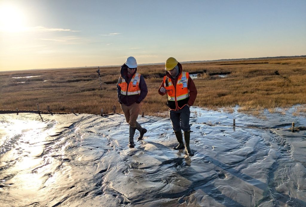
Andrew Lyda and Dr. Michael Grilliot (RAPID) touring the BUDM placement site.

Research Projects

This project will refine remote sensing techniques to monitor morphological and ecological trends of beneficial use o...
Facebook
Twitter
LinkedIn
Email

More Posts

Research Update: New Framework for Evaluating Nature-Based Solutions Using Remote Sensing Data

Research Update: New Framework for Evaluating Nature-Based Solutions Using Remote Sensing Data

Measuring the Success of Nature-Based Solutions Nature-Based Solutions (NBS) are becoming increasingly vital for protecting…
From Dredged Material to Thriving Mangroves: Florida Study Releases Key Restoration Data

From Dredged Material to Thriving Mangroves: Florida Study Releases Key Restoration Data

A new collection of datasets produced for the “Beneficial Use of Dredge Material in Mangrove…
Engineering With Nature® Announces New Publication on Advancing Environmental Management Practices

Engineering With Nature® Announces New Publication on Advancing Environmental Management Practices

The Engineering With Nature® (EWN®) initiative is proud to share a new publication led by…