A new collection of datasets produced for the “Beneficial Use of Dredge Material in Mangrove Restoration Projects” research initiative is now available, offering crucial insights for coastal restoration efforts. This release includes five datasets that provide multi-faceted indicators to assess coastal wetland conditions and inform the design of Nature-based Solutions.
Restoring a Vital Ecosystem
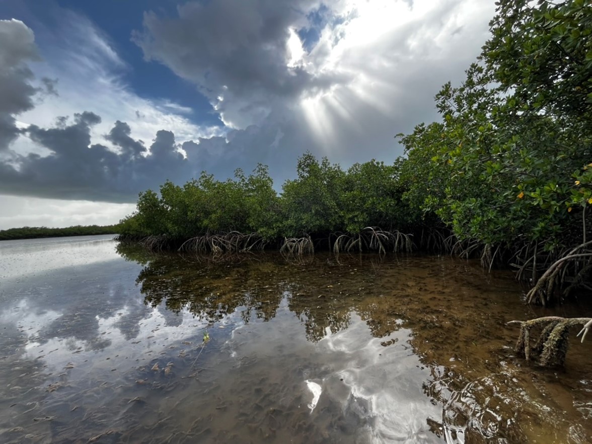
Mangrove forests are critical ecosystems that offer numerous benefits, including protecting coastlines from erosion and storm surges and serving as vital nurseries for fish and invertebrates. However, these habitats are under threat from human activities, leading to significant losses worldwide. To address this, a new study has developed a rapid, yet comprehensive, assessment protocol to diagnose the specific factors causing mangrove die-off and preventing natural regeneration.
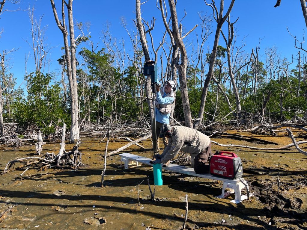
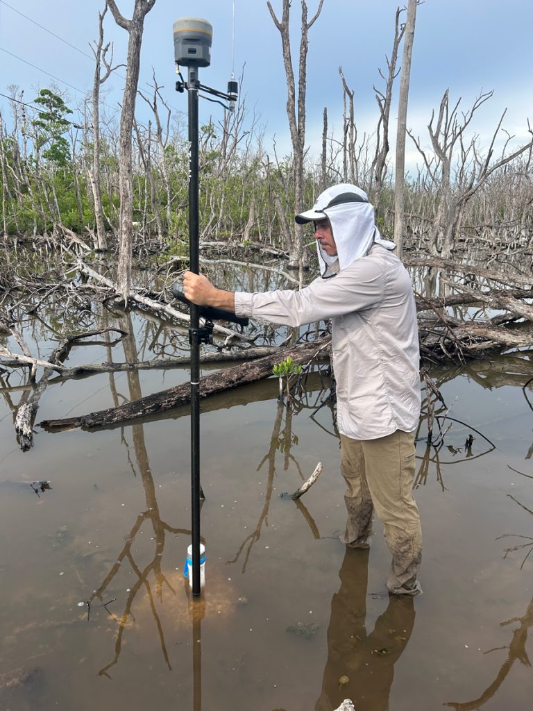
The data, collected in September 2025 at a degraded mangrove forest in the J.N. “Ding” Darling National Wildlife Refuge, is a key part of this novel diagnostic approach. The assessment uniquely combines topographic and hydrologic measurements to reveal how land elevation and water flow are linked to the health of the mangroves. A key finding is the critical importance of “elevation capital”—the proper soil height needed to restore the natural feedback loops between the water cycle, plants, and soil.
This diagnostic work directly informs the restoration plan, which will use innovative Nature-based Solutions. These include tidal reconnection and the “thin layer placement” of dredged sediments, a technique that mimics natural events like hurricanes or floods that deposit sediment. By strategically raising the soil elevation, the project aims to create the right conditions for the mangrove ecosystem to self-organize and thrive once again.
A Blueprint for the Future
This research aligns with the principles of Engineering With Nature (EWN) by using natural processes to restore ecological function while providing social and economic benefits. The knowledge gained will equip USACE districts and other stakeholders with the necessary information to implement beneficial use of dredged material in mangrove systems. This approach has the potential to be applied in coastal areas across the southeastern United States and other U.S. territories.
The initial collection of datasets is now available on the Smithsonian’s Figshare platform, providing a detailed picture of the mangrove environment. The five currently available datasets include:
- Forest Structure Inventory: Measurements of tree diameter at breast height(DBH) and tree heights.
- Seedlings and Saplings Density: Data on the density of young mangroves,indicating regenerative potential.
- Soil Depth Series: Information on soil composition and organic content.
- Water-Level Data: Continuous measurements of water levels in both impoundedand natural mangrove areas.
- RTK GPS Survey: High-precision soil surface elevation data to model thetopography.
This initiative represents a significant step forward in developing sustainable and effective strategies for mangrove restoration and coastal resilience. Future datasets, including a drone Lidar topographic survey, R-SET surface elevation time series, and updates to the water level time series, are also planned for release on the platform. The primary dataset can be found at smithosian.figshare.com, with the other datasets also available on the Figshare platform.