
Beneficial Use of Dredge Material in Mangrove Restoration Projects
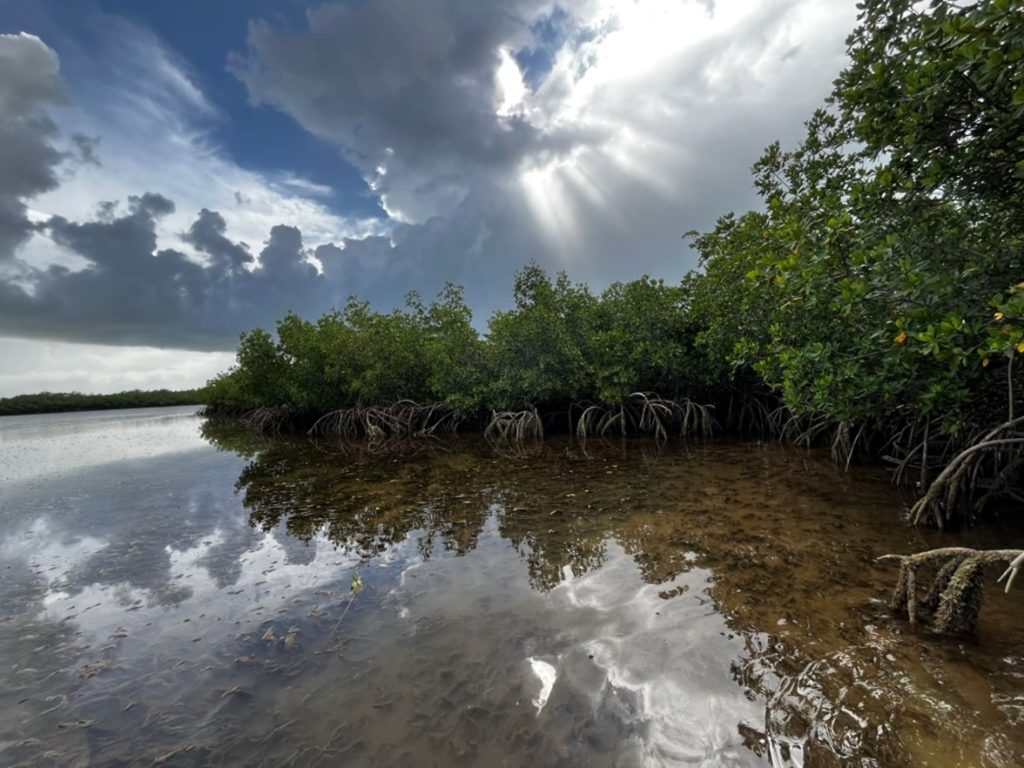
The overarching goal of this project is to provide the United States Army Corps of Engineers (USACE) with science-based evidence on how thin layer placement (TLP) influences mangrove ecosystems. At present, the effects of TLP on mangroves remain largely unknown, creating a critical knowledge gap that limits the ability of USACE to effectively plan and […]
Quantifying Hybrid Dunes for Barrier Island Resiliency
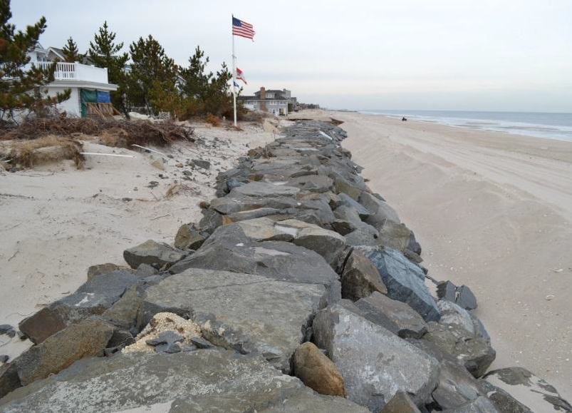
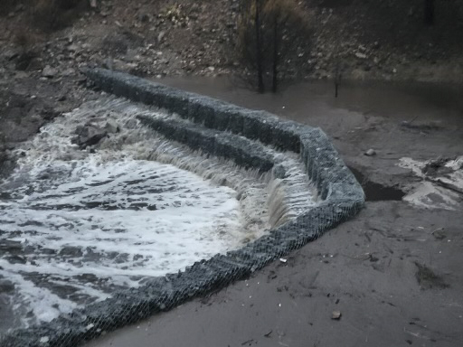
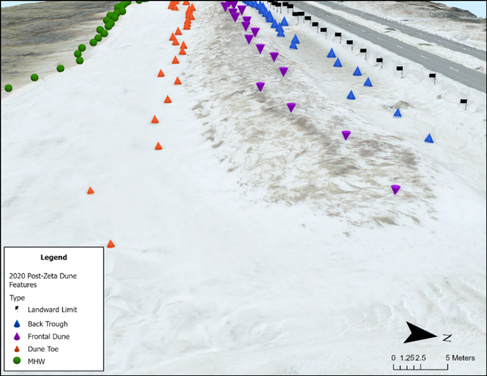
This project evaluates the effectiveness of hybrid dune systems—combinations of natural and hardened materials—for enhancing coastal protection and barrier island resilience. Through physical and ecological experiments, combined with life-cycle economic modeling, the team will generate data to guide the design, planning, and performance assessment of hybrid dunes. The effort will establish a testable framework for […]
Idealized Natural Infrastructure Simulator to Quantify Benefits
This project develops a standardized, simulation-based framework for evaluating the performance and benefits of natural infrastructure (NI) in coastal storm risk management. Using existing planning models and case study data, the research team will build idealized NI profiles (reefs, wetlands, barrier islands) and run multi-lifecycle simulations to quantify their storm protection and economic benefits. The […]
Reproducible Framework Standardized Methods to Score Resilience-Focused Outcomes of Nature-Based Solutions
This project develops a standardized, repeatable framework for assessing the broad, resilience-focused benefits of Nature-Based Solutions (NBS). By integrating ecological, economic, and community metrics—including the new Biodiversity Security Index (BSI)—the framework enables practitioners to evaluate alternatives more holistically. A pilot in the Great Lakes Region will test the methodology, leading to tools and publications that […]
Ecosystem and Flood Risk Management Compatibility Investigation
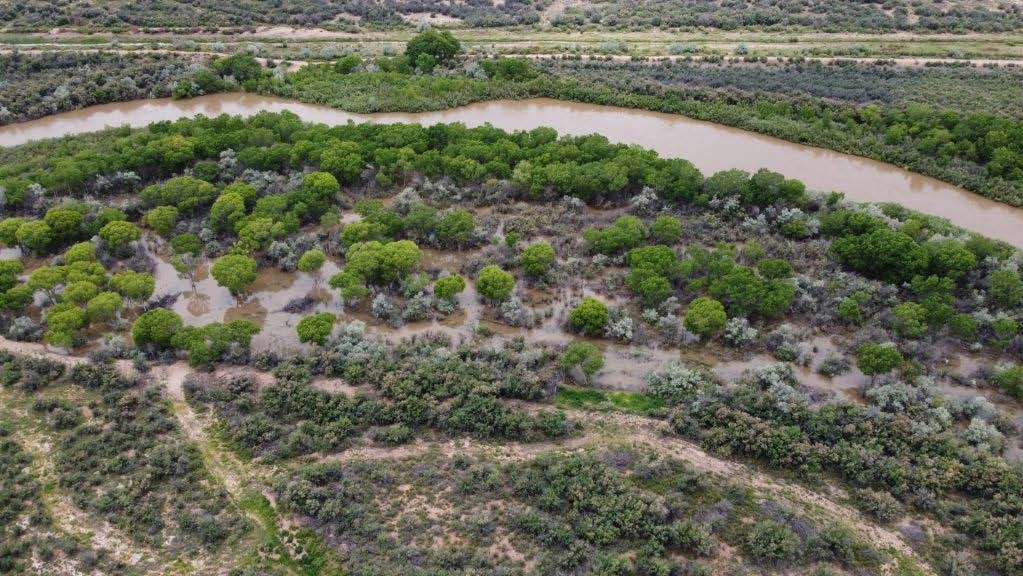
This research project investigates how Natural and Nature-Based Features (NNBF) have been used along the Rio Grande and its tributaries to support ecosystem restoration and flood risk management (FRM). Through case study documentation, field visits, and stakeholder engagement, the team will develop design guidance tailored to the arid Southwest. A regional geodatabase and a Design […]
Natural Infrastructure Tools for the Arid Southwest
This project will deliver design resources and implementation guidance to help USACE and partner agencies integrate Natural and Nature-Based Features (NNBF) into flood risk and erosion management in arid and semi-arid regions. It addresses both technical and institutional barriers, ensuring greater adoption and impact of EWN practices in these challenging environments.
Performance Metrics for Nature-Based Solutions: Leveraging 25 Years of USACE and Partner Remote Sensing Data
This project uses more than 25 years of USACE and partner coastal remote sensing data to evaluate the long-term performance of nature-based solutions (NBS) implemented across the country. By integrating existing geospatial tools with cloud-based analysis, the team will develop standardized performance metrics that support design, monitoring, and adaptive management of coastal NBS across the […]
Quantifying the Benefits of Nature-Based Solutions Through Numerical Modeling
This project uses numerical models and life cycle risk assessment to quantify the hydrodynamic and cost benefits of nature-based solutions (NBS) such as reefs, wetlands, and islands. Through scenario testing under extreme storm conditions, the research team will develop guidance to help engineers and planners design more effective, resilient, and cost-efficient NBS projects. Comparisons with […]
Integrating water resources infrastructure with agricultural land management to advance nature-based solutions for water quality
This project aims to harmonize water resources infrastructure, such as reservoirs and levees, with agricultural land management across the U.S., presenting nature-based solutions for improved water quality. Our objectives include identifying potential integration areas, modeling at least one such system based on stakeholder preferences, testing a nature-based solution within the selected system, devising methods to […]
Testing Efficacy of Remote Sensing to Measure Multiple Environmental Benefits of Water Level Management: A Case Study at Wilson Lake, Kansas
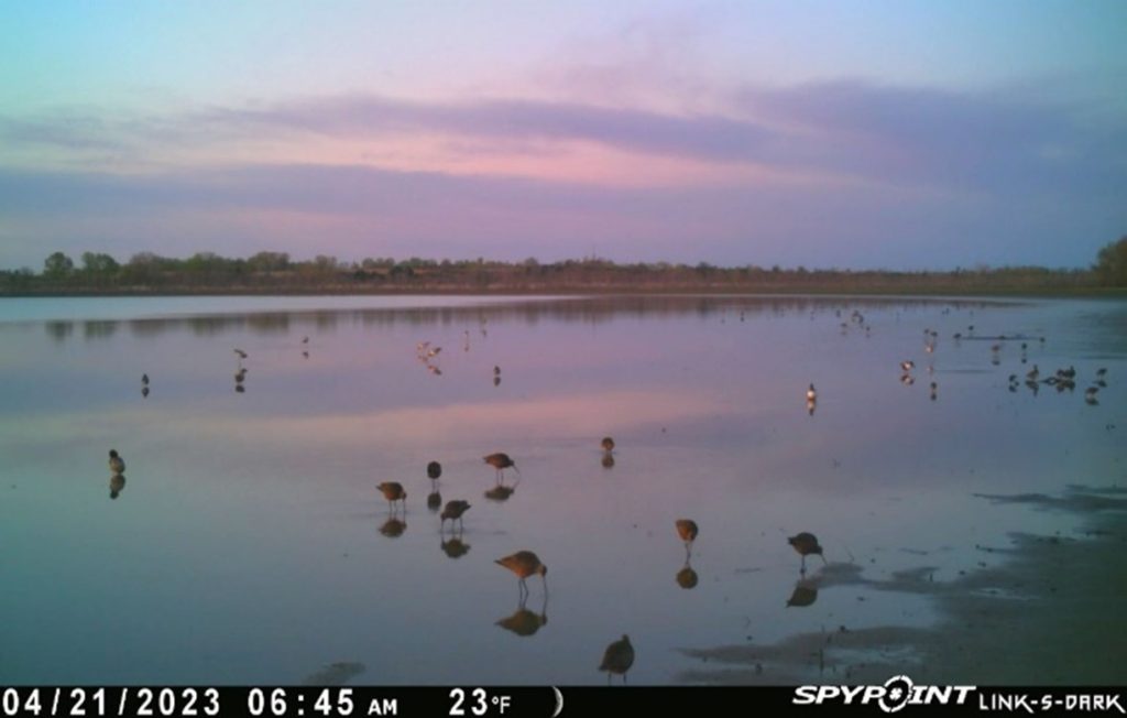
Water level management (WLM) is an important management approach for many different benefits at reservoirs including threatened and endangered species (TES) management. Whooping Cranes (WHCR) are an endangered species that require shallow water depths (<18 inches), open spaces without nearby woody or tall vegetation, and a glide path free of obstructions for roost locations. Many […]