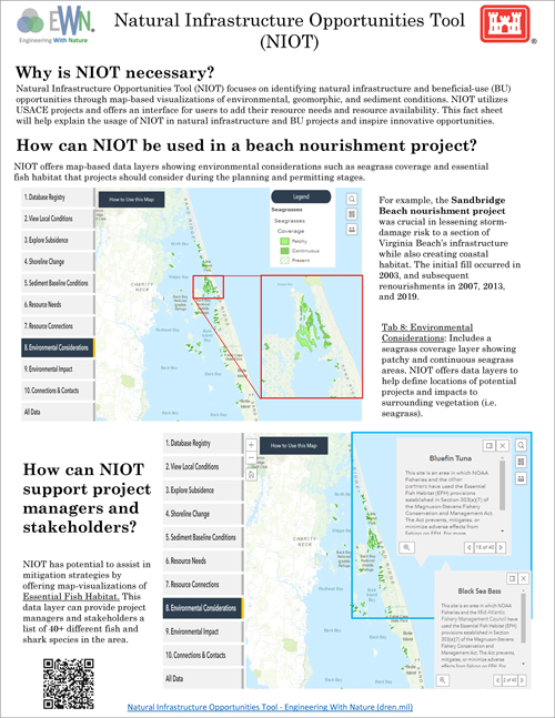
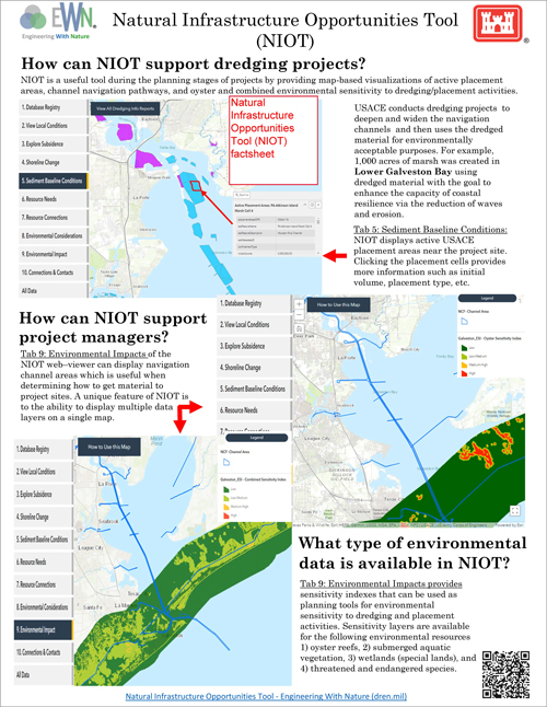
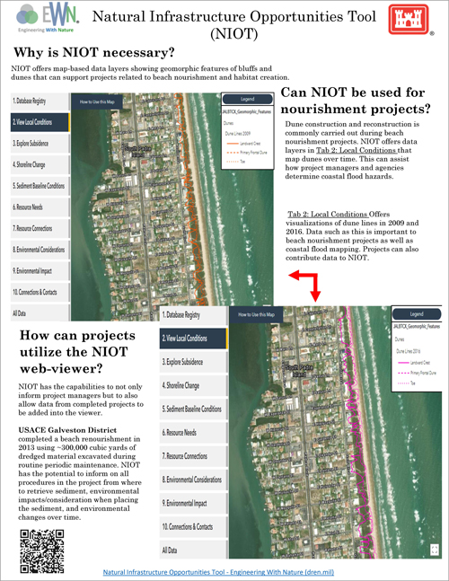
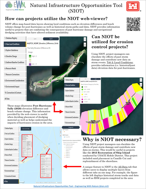
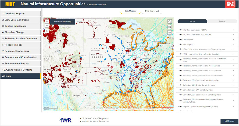
The public facing Natural Infrastructure Opportunities Tool (NIOT), developed in collaboration with the Natural Infrastructure Initiative, focuses on identifying natural infrastructure and beneficial use opportunities. Through map-based visualizations of environmental, geomorphic, and sediment conditions, as well as upcoming USACE projects, and an interface for users to add their resource needs and resource availability, this portal will help discover natural infrastructure connections and inspire innovative opportunities.
The aim of the viewer is to provide a data informed perspective for multiple stakeholders with the goal of finding mutually beneficial strategies to improve and increase investment in the use and creation of natural infrastructure. The viewer is intended to be used in collaboration, as a platform to generate new ideas about natural infrastucture projects during the planning stages.
The NIOT viewer was developed through iterative collaboration with representatives from Caterpillar Inc., The Nature Conservancy, Great Lakes Dredge and Dock, AECOM, USACE ERDC and USACE Mobile District. The viewer brings together datasets from multiple sources in one place and also allows users to identify current infrastructure projects, and directly add resource or project needs. Resource connections, as well as points of contact, are integrated into supporting databases and appear on the viewer map. The viewer includes national and regional datasets, and also provides users the option to request the addition of user-identified geospatial data layers, allowing NIOT to be adapted for regional use and fine tuned for local application.
Explore these factsheets to see how NIOT can be applied to various scenarios, including beach nourishment, erosion control, dredging, and dune restoration. Each factsheet features screen captures and example applications, showcasing the practical benefits and effectiveness of NIOT in real-world situations.

