This project is featured in Engineering With Nature: An Atlas, Volume 3.
Location: Fletcher, Missouri, United States
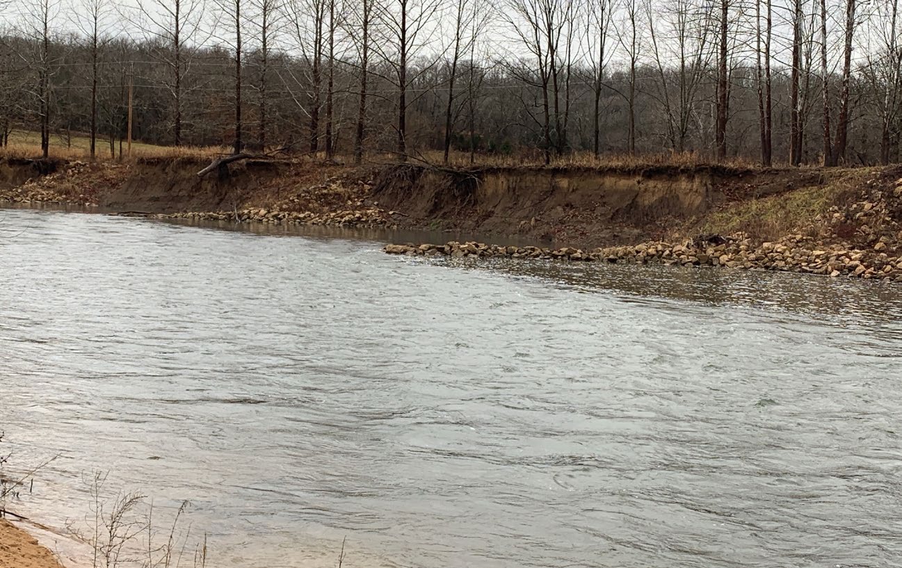
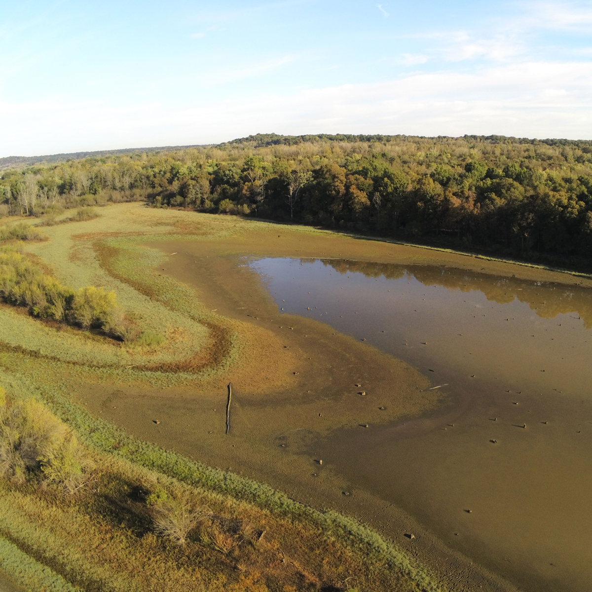
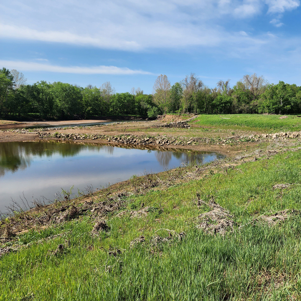
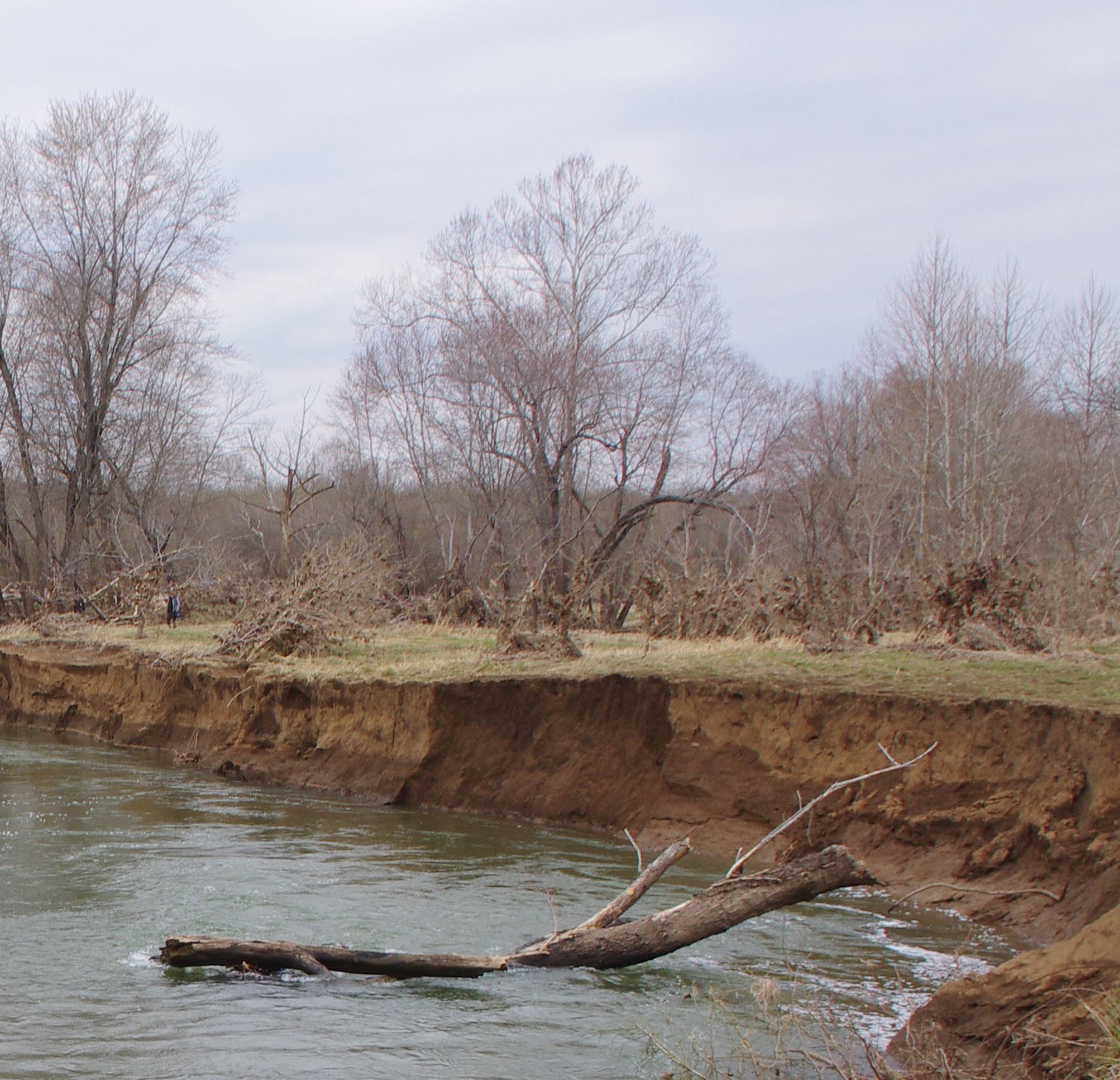
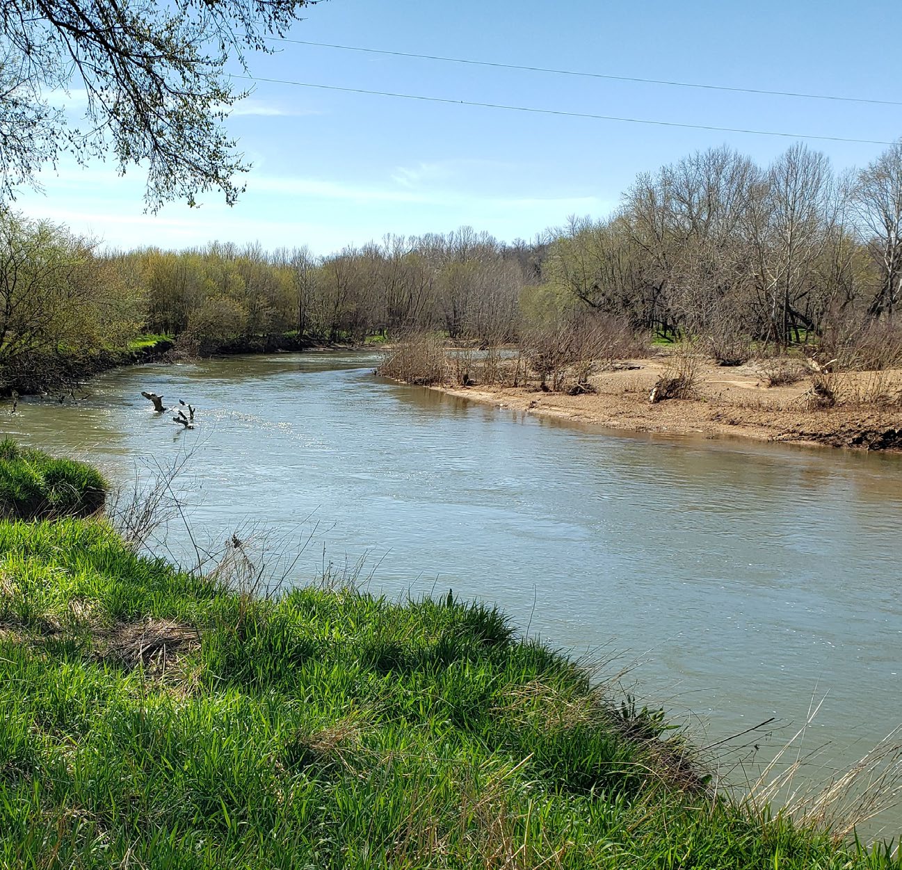
Restoring a river to its historical natural form and function. Until the early 1970s, the Southeast Missouri Lead District was the world leader in lead production for nearly 100 years. Mining operations introduced gravel, sand, and silt-sized mine waste material into the Big River. During elevated flows, this material is transported downstream, depositing into both the channel and floodplain. Most impacted areas of the watershed are now designated as a U.S. Environmental Protection Agency (USEPA) Superfund site. In coordination with state partners, the U.S. Army Corps of Engineers (USACE)–St. Louis District entered into an agreement with USEPA to design and construct a series of bank stabilization features in the Big River watershed near the confluence of the Calico Creek tributary. Historical imagery and topographic maps suggest that heavy equipment severely altered Calico Creek, creating an undesirable configuration near its confluence with the Big River. This project reconfigured the creek channel to its assumed previous layout and dimension, restoring it to a more natural form and function more conducive to balanced sediment transport through the reach.
Producing Efficiencies
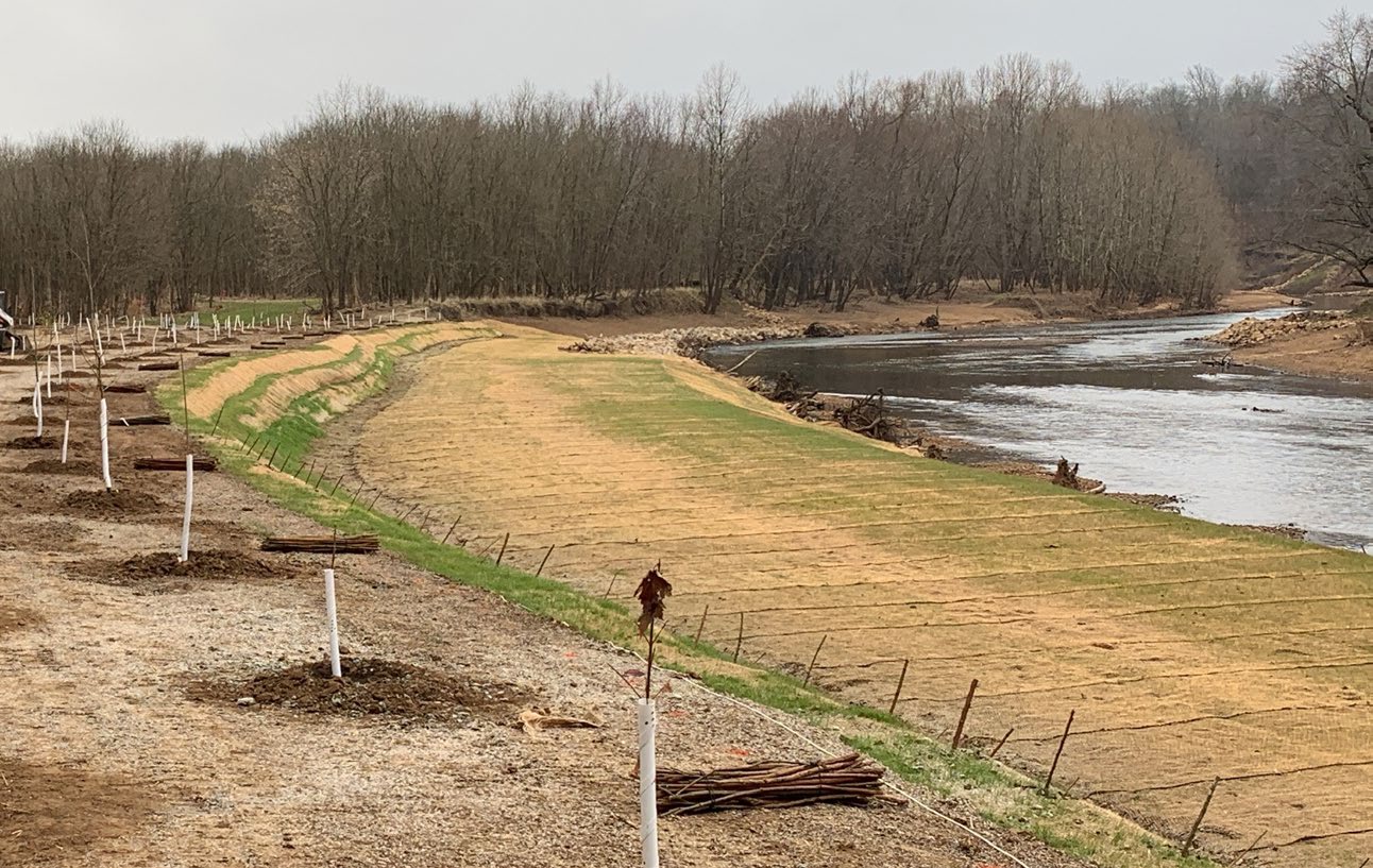
Sediment excavated from Calico Creek’s new channel was reused as a “plug” for the old channel, greatly reducing haul distances and the need for bringing in new material. Similarly, in the construction of the three bank stabilization features within the Big River, excavated in-channel material was reused landward of the new layout to fill the old channel (as opposed to being hauled off site with new fill material needing to be delivered). Nearby cleared trees were also selectively used as root-wad revetment. Finally, scour calculations and velocity modeling optimized the rock placement rate for bank toe protection with an approach that balanced cost with the desired level of security.
Using Natural Processes
Bank stabilization features were constructed using rootwad revetment, weirs, and longitudinal peaked stone toe protection (LPSTP) offset from the eroded bank. Root-wad revetment provides energy dissipation at the bank’s toe while creating extensive in-stream cover for aquatic species. Weirs throughout the site provide additional stabilization while creating hydraulic and bathymetric variance in the channel. LPSTP provides a fixed channel border while recruiting sediment deposition between itself and the eroded bankline. Native vegetation was planted throughout the site. Species were selected to provide rooting to hold soil in place long-term while withstanding flooding at the elevation at which they were planted.
Broadening Benefits
At Bank 1, the large offset between the new channel and the old bankline provides a sink for lead-laden soil to deposit and lock in place outside of the channel, which improves the habitat for aquatic species highly sensitive to lead levels. At Bank 3, the use of root-wad revetment provides additional aquatic habitat, which is beneficial for the environment and for fishing. The new orientation of the river channel provides a clearer and easier path for recreational users, with fewer obstacles and snags than before this project.

Promoting Collaboration
The USACE St. Louis District coordinated with USEPA, the U.S. Fish and Wildlife Service, and Missouri Department of Natural Resources to balance agency authorities, funding limitations, and project objectives. Ultimately, a project was constructed to address environmental concerns while providing value to three adjacent landowners who were losing their banklines.