This project is featured in Engineering With Nature: An Atlas, Volume 1.
Location: Barnegat Bay, Ocean County, New Jersey, United States
Background
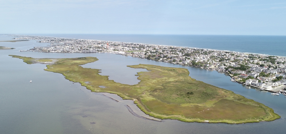
Mordecai is an undeveloped back barrier island that runs parallel to the Barnegat Bay shoreline of Beach Haven, New Jersey (Figure 1). In addition to providing habitat for a wide range of estuarine organisms and nesting shorebirds, the island serves as a wave-break, protecting the adjacent developed shoreline of Beach Haven from the erosive action of waves generated in Barnegat Bay.
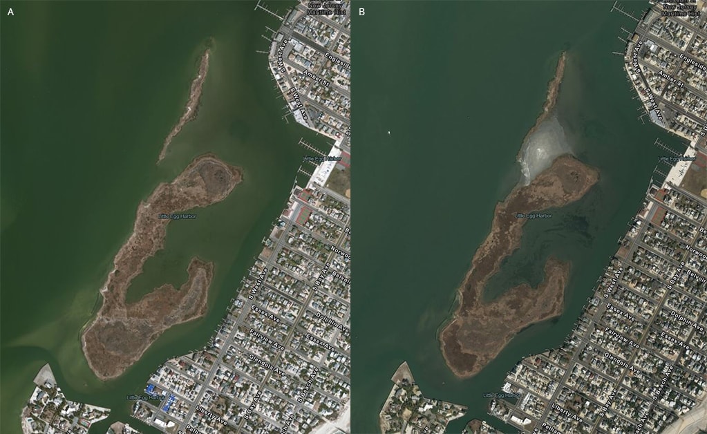
Over the past century, persistent wave action has taken a toll on Mordecai Island, resulting in a loss of roughly 50 percent of its total area and leading to a breach that effectively separated the island into two lobes (Figure 2). Continuing erosion threatens the existence of Mordecai Island, its biological communities and habitat, and the vital role that it plays in protecting the Beach Haven shoreline.
Project Description
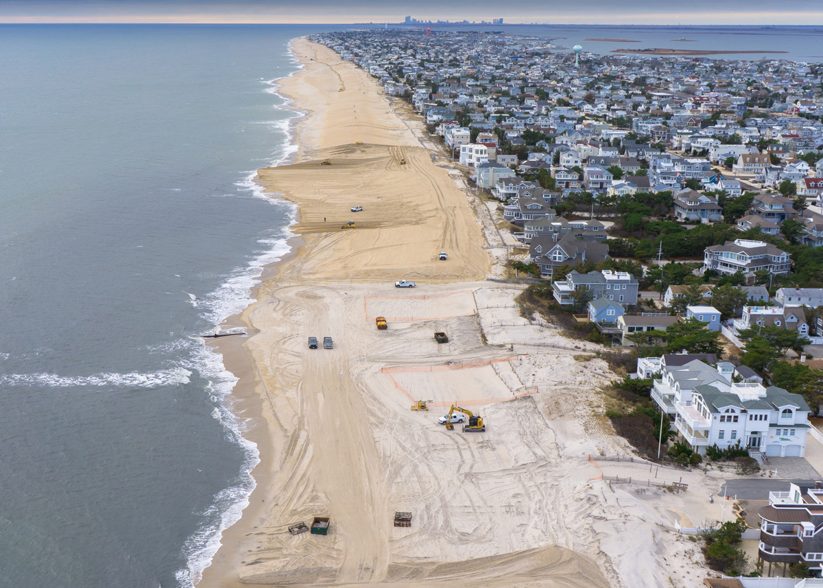
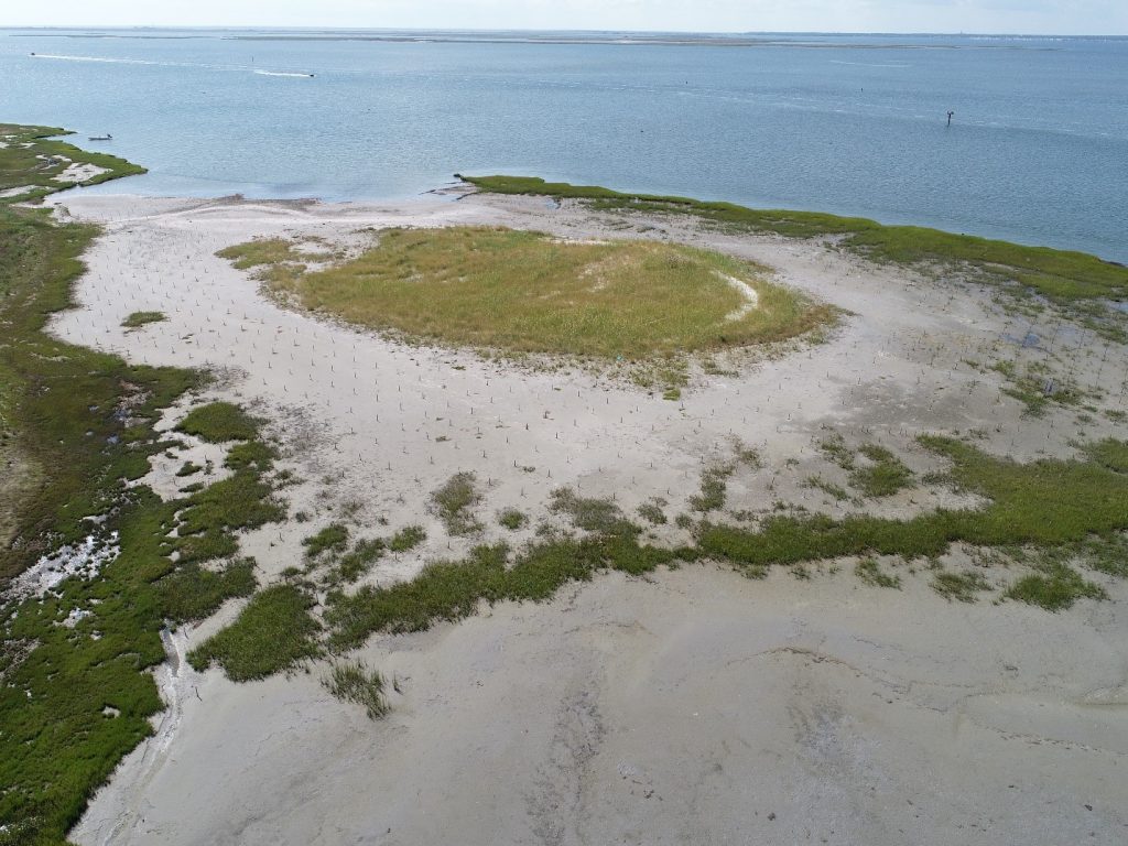
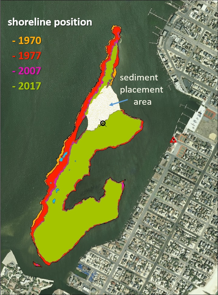
In 2015, the US Army Corps of Engineers (USACE) Philadelphia District used sediment dredged from the New Jersey Intracoastal Waterway (NJ ICW) to fill the erosional gap that separated the two remaining parts of Mordecai Island. The project design involved the use of ~30,000 cubic yards of sediment to create a central high-elevation mound intended to provide habitat for shorebird nesting. The placement area was later planted with native salt marsh and transitional and upland vegetation (Figure 3).
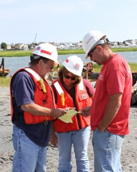
Monitoring
To determine the effectiveness of dredged material placement and other shoreline modifications in stabilizing the island and to quantify the success of ongoing restoration efforts, the Philadelphia District partnered with the National Oceanic and Atmospheric Administration (NOAA)’s National Centers for Coastal Ocean Science (NCCOS) and the Mordecai Land Trust to track changes in surface elevation and shoreline position over time and monitor changes in biological communities. NOAA NCCOS is also evaluating potential ecological impacts of these activities by monitoring changes in saltmarsh vegetation, seagrass cover, and the abundance and variety of nearshore benthic invertebrates. An understanding of how each of these groups responds to the shoreline modifications occurring on Mordecai Island is crucial to determining the broader ecological impacts of sediment placement and shoreline protection strategies and can be the basis for change detection.
Study Results
To better understand the amount of erosion occurring along the western side of the island that experiences high boat wakes, NCCOS developed digital elevation models from drone aerial photography and conducted shoreline change analyses using a combination of historical aerial imagery and on-the-ground surveys. An analysis of elevation change between 2017 and 2019 showed a redistribution of sediments within the placement region, that without additional sediment and stabilization by planting, is likely to result in the formation of a channel and, ultimately, lead to the island being separated once again into two lobes. Similarly, analyses of historical shoreline positions indicate that between 1970 and 2019, the western shoreline of Mordecai Island retreated at an average rate of 0.83 meters per year leading to a cumulative loss of roughly 15 acres of land. However, there is also evidence that the shoreline stabilization structures along the southwestern shoreline have minimized erosion on the adjacent shoreline (Figure 4). In addition, results of this study revealed that there were no long-term changes to the benthic intertidal community which has been a concern for in-water sediment placement activities such as the Seven Mile Living Laboratory (SMILL).
Project Significance
Shoreline erosion is a major source of the sediments that end up clogging navigation channels and leading to the need for maintenance dredging; it is also a cause of habitat loss for marsh islands like Mordecai. Beneficial use of sediments to restore these habitats can be a part of the solution. Monitoring and continued data collection will inform adaptive management strategies and further document the rate of ecosystem service provision and protective capacity of Mordecai Island. Research to capture appropriate ecosystem variables at demonstration sites like this will play a pivotal role in determining the efficacy and optimal use of such applications.
References
Davis,J.L., Balthis, W.L., Greene, M.D., Giannelli, R.A. 2020. Ecological Assessment of the Beneficial Use of Dredged Sediments for Island Restoration: Mordecai Island, Barnegat Bay, NJ. NOAA Technical Memorandum NOS NCCOS 287, Silver Spring, MD. 52pp.doi:10.25923/gja6-a224