Measuring the Success of Nature-Based Solutions
Nature-Based Solutions (NBS) are becoming increasingly vital for protecting our coastlines from storm damage while also providing significant environmental and socio-economic benefits. However, a major hurdle has been the absence of standardized and scalable methods to measure whether these projects are achieving their desired outcomes. Without clear performance metrics, it is difficult to assess the effectiveness of NBS projects, adaptively manage them, and justify future investments. For many coastal practitioners, the high cost of traditional field monitoring presents an additional barrier to effective evaluation.
A Cost-Effective Framework Using Remote Sensing
In a recent article titled “Coastal Nature-based Solutions and Remote Sensing Data: Selecting Performance Metrics and Evaluating Data Availability,” published in Shore and Beach, researchers from the USACE Engineering with Nature (EWN) program developed a standardized process to overcome this challenge. The new framework leverages over 25 years of publicly available remote sensing data from the USACE National Coastal Mapping Program (NCMP), including airborne lidar and high-resolution imagery.
The study, titled “Performance Metrics for Nature-Based Solutions: Leveraging 25 Years of USACE and Partner Remote Sensing Data,” demonstrates how existing datasets, combined with established geospatial toolboxes, can be used to conduct robust, repeatable, and cost-effective performance assessments. The authors applied this framework to three case study sites:
- Ship Island, Mississippi: A barrier island restored in 2018.
- South Ponte Vedra Beach, Florida: A beach-dune system that underwent recent NBS-focused restoration.
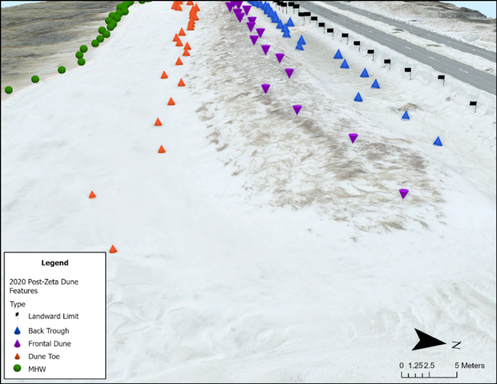
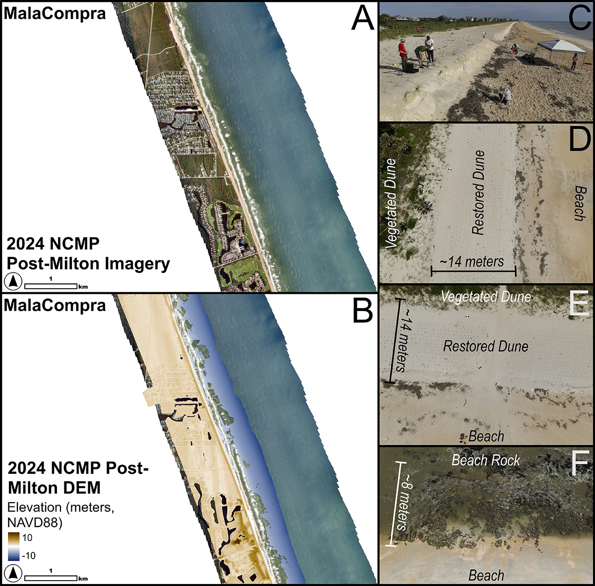
- MalaCompra Park, Florida: Another beach-dune system with recent NBS restoration.
For these sites, the researchers identified key performance metrics such as island and dune dimensions, shoreline change, wetland elevation and area, and vegetation health. These methods are also transferable to other types of NBS, including salt marshes, mangroves, and oyster reefs.
Empowering Practitioners and Enhancing Coastal Resilience
This research provides a practical and accessible framework for coastal practitioners who may not have the resources for extensive field monitoring. By using readily available data and tools, they can now more easily evaluate the performance of their NBS projects.
This work empowers decision-makers with the information they need to adaptively manage and improve coastal restoration efforts. The publication serves as a foundational guideline for the coastal community and paves the way for future analytical products that will further enhance our ability to design and implement effective nature-based solutions. Ultimately, this research contributes to building more resilient coastlines for the future.