
Investigating The Relationship Between Soil Respiration Rates And Stable Carbon Pools
At the 7 February 2024 Society of Wetlands Scientists Biogeochemistry Section Webinar, Anthony Mirabito, a Ph.D. candidate under the University of Central Florida, Aquatic Biogeochemistry Lab presented on his research investigating the relationship between soil respiration rates and stable carbon pools in a laboratory setting. Collaborators
EWN Workshop Explores 3D Printing with Dredged Sediment for Nature-Inspired Infrastructure
The recent Engineering With Nature® (EWN) Workshop on 3D Printing Natural Material for Nature-Inspired Infrastructure marked a significant milestone in the quest for innovative solutions for coastal resilience. Held from February 7-8, 2024, in Vicksburg, MS, the workshop brought together a diverse group of experts from government, academia, and private industry to explore the potential […]
Research Update: Assessing Living Shoreline Stability – A Kickoff Workshop

In a collaborative effort to address the physical and ecological stability of living shoreline projects in coastal Georgia, the Engineer Research and Development Center (ERDC) Environmental Laboratory (EL) Coastal Ecology Team, in partnership with the Georgia Department of Natural Resources (GA DNR), conducted a kickoff workshop for the EWN living shoreline stability and function project […]
ResiRiver Project Paves the Way for Riverine Nature-Based Solutions (NBS) Across Northwestern Europe
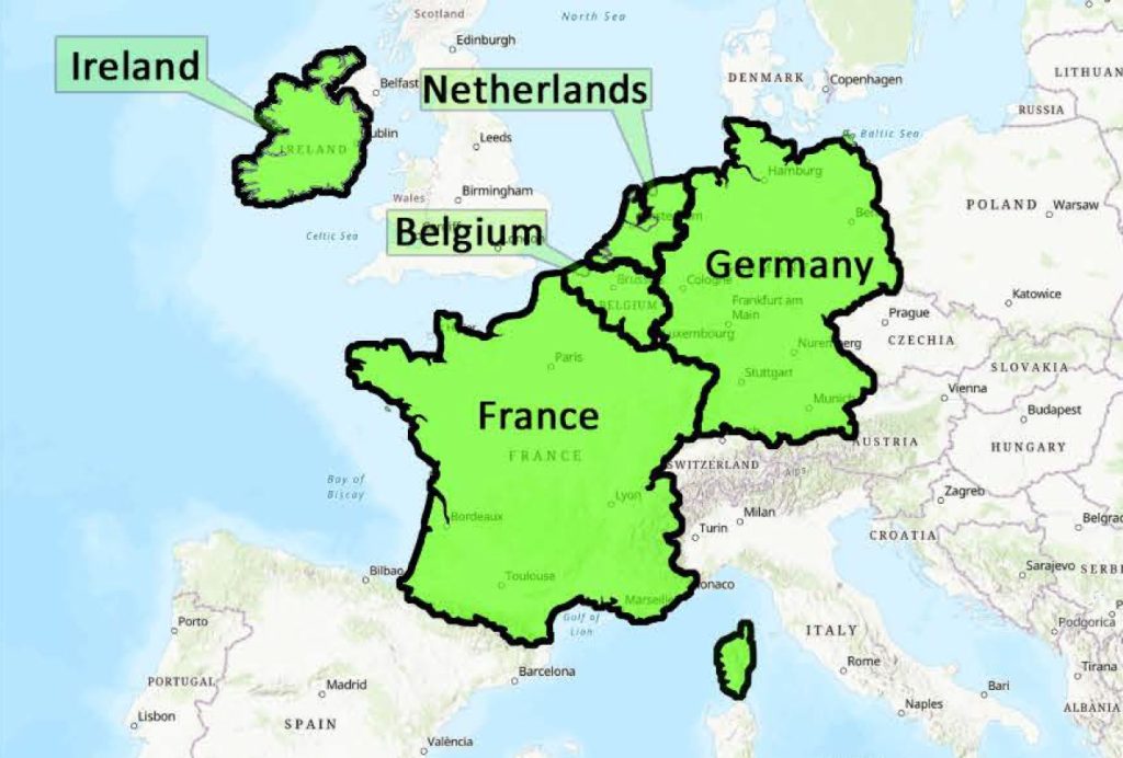
In a collaborative effort spanning countries, representatives from the Netherlands, Germany, Belgium, France, Ireland, Scotland, and the USA convened in Nijmegen, Netherlands on October 26th and 27th to officially launch the ResiRiver project. The primary objective of this international initiative, led by the Dutch Ministry of Infrastructure and Water Management (Rijkswaterstaat), is to upscale and […]
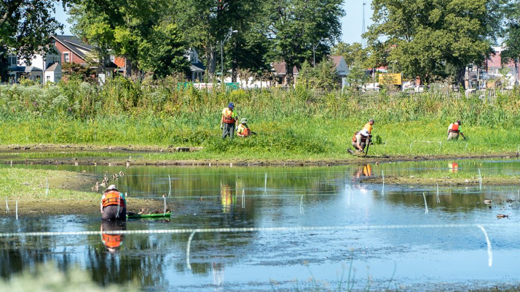
Research Update: Monitoring the Impact of Beneficially Used Dredge Material
In a collaborative effort, Engineering With Nature researchers joined forces with researchers from Virginia Tech and the University of Florida to investigate the establishment of a newly nourished mudflat at the Heislerville Dike in New Jersey. The Heislerville Dike, situated in the Heislerville Wildlife Management Area, faced an imminent risk of failure due to wave […]
“Radical Collaboration” for Coastal Solutions
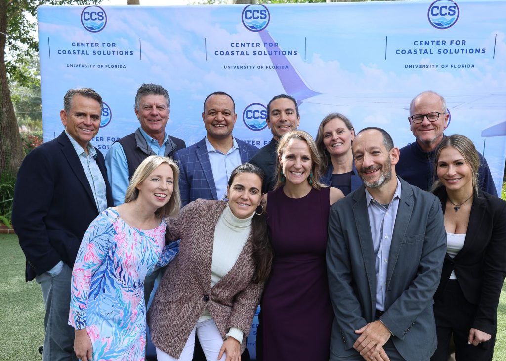
Our partners at the University of Florida recently hosted a year-end summit to reflect on progress and actional next steps towards coastal resilience. Joined by EWN National Lead, Jeff King, the summit emphasized the value of collaborative efforts to tackle emerging risks in coastal communities. Jeff highlighted the exponential growth of the EWN community, an […]
America’s Engineers are Engineering With Nature
The recent feature in “America’s Engineers: The People, Programs, and Projects of the U.S. Army Corps of Engineers” highlights the powerful impact of Engineering With Nature (EWN). While the concepts of Engineering With Nature have existed for some time, the deliberate integration of natural features into engineering solutions became a focused pursuit for USACE in […]
Collaborative Development of Natural and Nature-based Solutions for Coastal Resiliency in the Arctic and Adjacent Regions: A Workshop
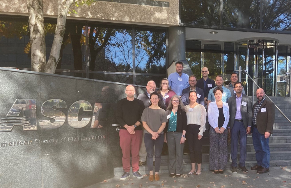
The American Society of Civil Engineers (ASCE) together with the U.S. Army Corps of Engineers’ (USACE) Engineering With Nature® (EWN) program and the National Research Council of Canada convened partners from across the circum-Arctic region in a hybrid workshop on October 24 and 25, 2023 to focus on applying natural and nature-based solutions (NNBS) in […]
Growing Resilience: A Planting Event in Collins Cove, Massachusetts
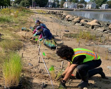
Background Coastal salt marshes are crucial ecosystems, offering flood management, nutrient retention, and biodiversity. Threatened by rising sea levels, nutrient runoff, extreme weather, and urban development, salt marsh restoration is increasingly critical. However, practitioners often face limitations in accessing locally sourced plant materials, which can better withstand a range of conditions and support coastal resiliency. […]
Assessing Shoreline Protection: A Step Forward in Nature-Based Solutions at Nolan River Lake

EWN researchers, Chris Haring and Autumn Murray, from ERDC Coastal and Hydraulics Laboratory (CHL) and the USACE Louisville District (LRL) engaged in site visits during the week of November 13, 2023. Their focus: evaluating existing shoreline protection methods, discussing adaptive management, and planning new projects. This initiative aims to explore alternative designs for shoreline protection, […]