This project is featured in Engineering With Nature: An Atlas, Volume 1.
Location: Lower Atchafalaya River, Louisiana, United States.
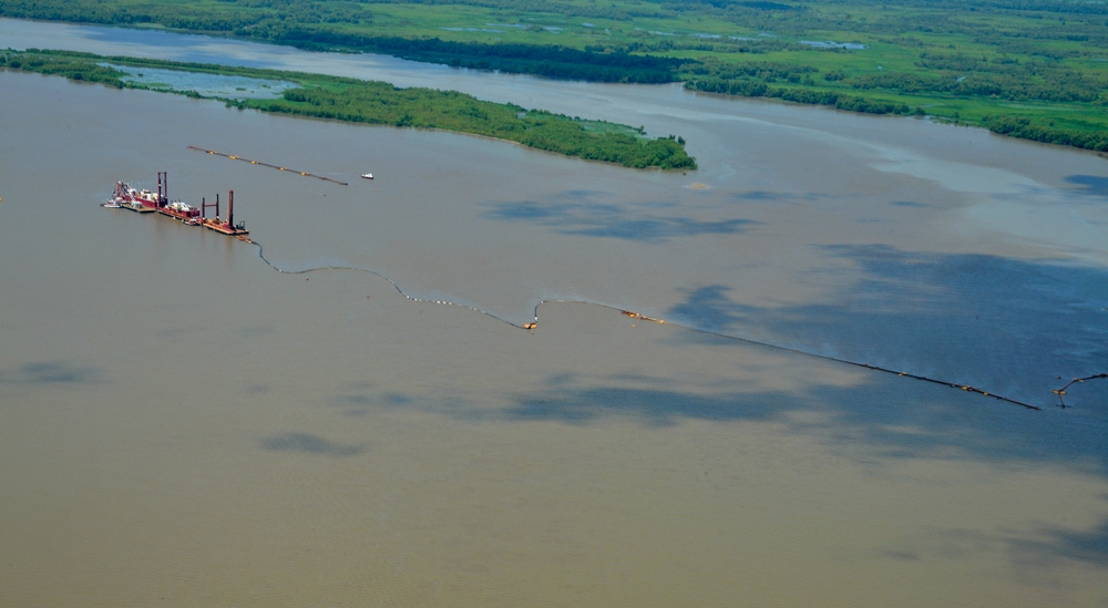
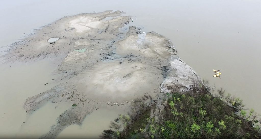
During the 1990s, placement of shoal material dredged from Horseshoe Bend of the lower Atchafalaya River occurred at wetland development sites located along the river’s banklines adjacent to the channel. Capacity of these placement sites was nearly exhausted by 1999. Thus, to meet the anticipated disposal requirements for future channel maintenance, the USACE New Orleans District (MVN) evaluated three placement alternatives: (1) convert the wetland development sites into upland disposal areas; (2) open water placement of dredged material via a long-distance pipeline into the open waters of Atchafalaya Bay; and (3) mounding of material at mid-river open water placement sites within a 350-acre area immediately adjacent to the navigation channel and upriver of a small naturally forming island. The third alternative was selected on a demonstration basis to investigate the impacts of mid-river placement on shoaling trends downriver of the site. Beginning in 2002, strategic placement of the sediment dredged from Horseshoe Bend occurred at the mid-river open water placement area. Placement of between 0.5 to 1.8 million cubic yards of sediment was conducted every 1 to 3 years which influenced and contributed to the development of an approximately 35 ha island mid-river (Figure 1). Sediment dredged from the adjacent Federal navigation channel during routine maintenance was strategically placed in mounds upriver of the island over a period of 12 years. The mounded material was dispersed by the river’s currents to self-design the unconfined island over time. While the strategic placement of dredged sediments upriver of a naturally-occurring island was initially conducted to reduce dredging costs and promote the island’s growth, additional ecological, and navigation benefits were realized using this innovative placement practice.
Project Description
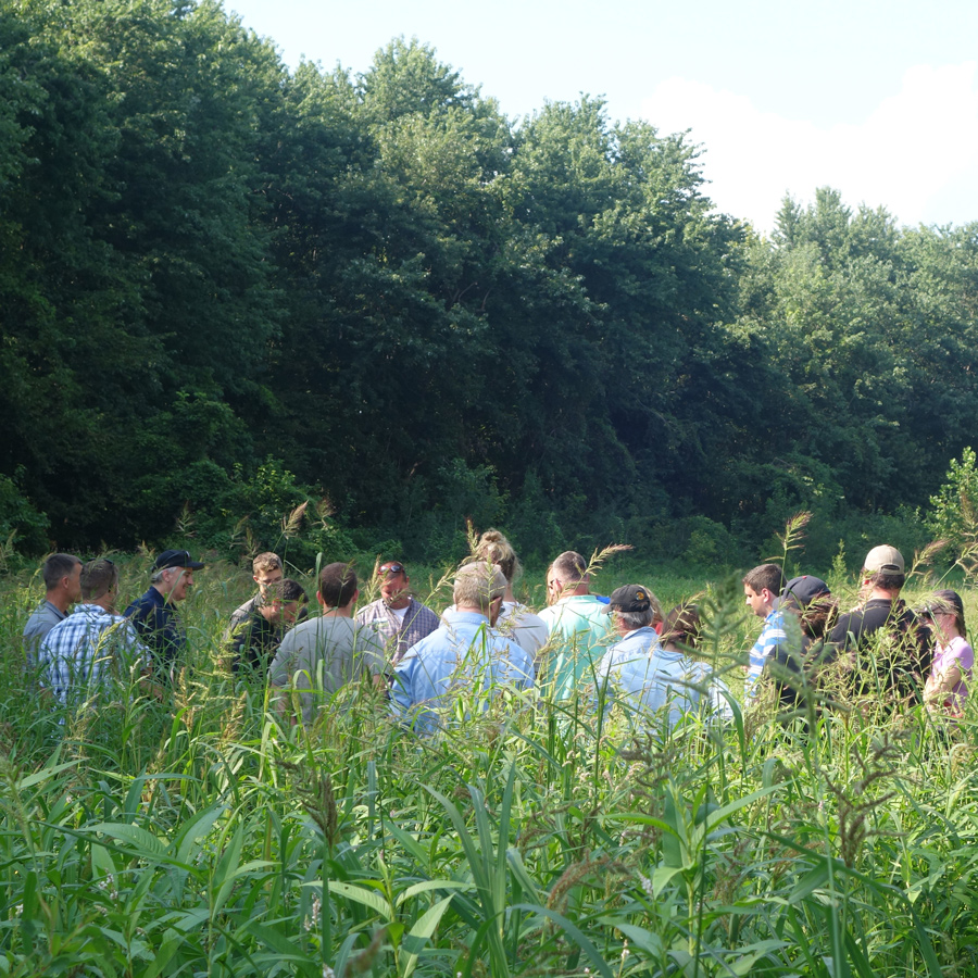
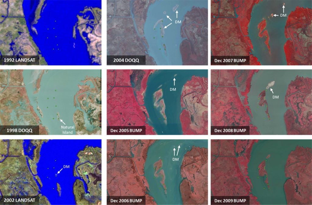
A USACE MVN and USACE Engineer Research and Development Center (ERDC) project team was formed to generate data and other information regarding ecosystem classification and mapping, floral and faunal composition of the island. To help understand how and why the island was formed over the last 12 years, the USACE conducted studies to better understand the hydrology of the river used to transfer the mounded material onto the island. Information regarding ecosystem classification and mapping and floral and faunal composition of the island were conducted to document ecological and other benefits being realized. In addition, multiple moderate and high-resolution aerial photographs available from prior to 2002 to the present clearly documented the growth of the island (Figure 2). To address this goal, project objective focused on demonstrating how dredged material can be used beneficially to nourish a naturally forming river island. Biology, ecology, and hydrodynamics were examined to catalog the island’s maturation for determining the effectiveness of this individual project in terms of restoring, creating, enhancing, and protecting the coastal Louisiana landscape.
Monitoring
The study used a multi-factor ecological assessment including: 1) landscape geomorphology, 2) ecosystem classification, 3) floral communities, 4) avian communities, 5) aquatic invertebrates, 6) soils and biogeochemical activity, and 7) hydrodynamic and sediment modeling. Ecological components comprising primary producers, microbial communities, invertebrates that form the basis of aquatic food webs, and higher organisms were studied, providing a comprehensive assessment of dredged material supported wetlands. This framework can be used in future studies examining the ecological, societal, and economic value of the strategic placement of dredged material applied in this manner. Results demonstrated that each of the factors examined at Horseshoe Bend Island proved comparable or exceeded the other study areas examined, including the naturally formed riverine island and a traditionally created dredged material supported island. This innovative beneficial use of dredged material for creating Horseshoe Bend Island can be applied in other riverine project scenarios to demonstrate the success and potential benefits of this application of the EWN practice of utilizing natural process for improving wetland creation and restoration outcomes.
Study Results
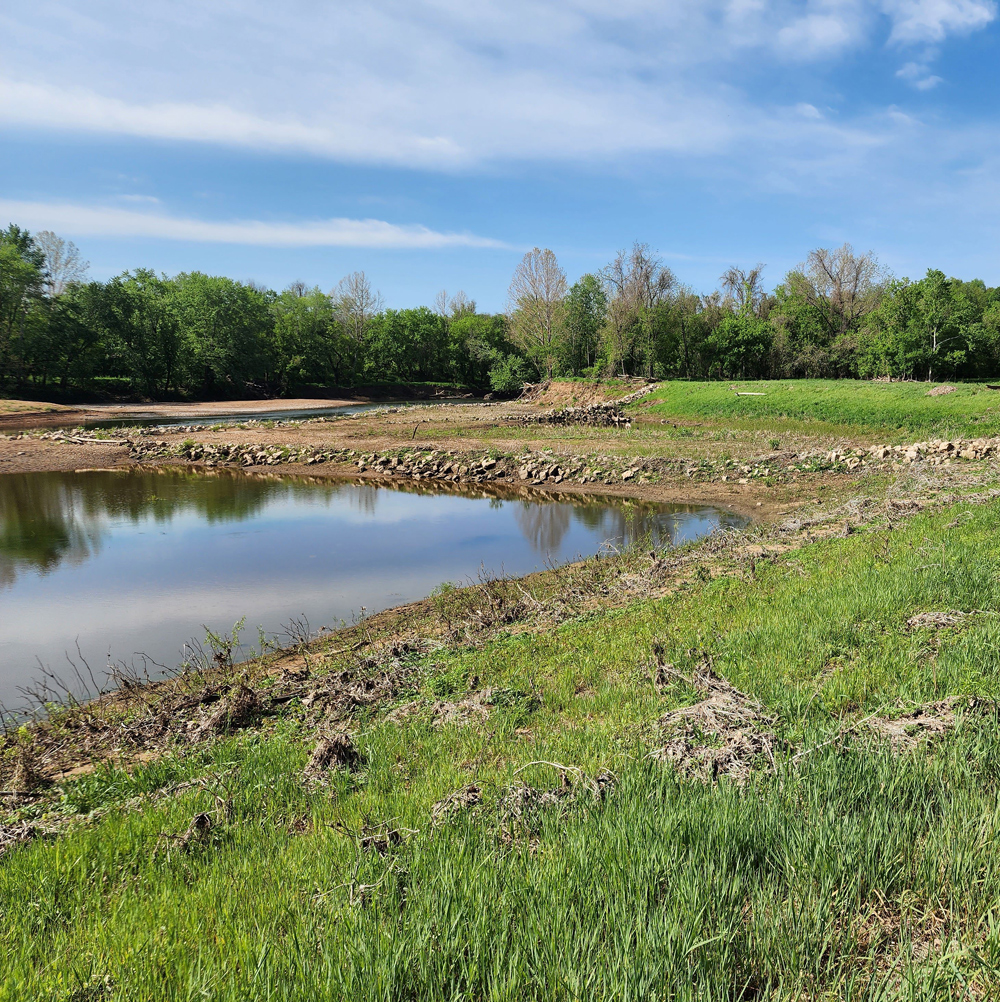
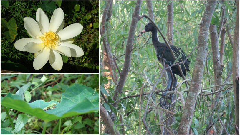
Our results indicated that Horseshoe Bend Island is providing four distinct habitat types supporting complex communities of vegetation, invertebrates, soil microbes, and higher organisms such as birds. Horseshoe Bend Island contains a wide variety of vegetation including >85% native species, with species richness values exceeding observations from both traditional dredged material supported and natural reference areas. The design utilized at Horseshoe Bend Island resulted in landscape and landform characteristics (e.g., distance from shore, flooding regime) that support a large, successful wading bird rookery. Horseshoe Bend Island also supports more invertebrate abundance and variety than natural islands in the region that lack the emergent aquatic bed landforms resulting from the strategic placement of dredged materials.
Previous studies only provided qualitative documentation of the fauna, flora, and geomorphology of the island. Completed quantitative surveys of the plant communities that have developed on the island indicated that Horseshoe Bend Island provides habitat and biogeochemical functions at rates comparable or exceeding observations made at a traditional dredged material supported island and a natural reference island in the area. Wetland classification and analysis of geomorphic features demonstrated that Horseshoe Bend Island provides a variety of habitat types supporting complex communities of vegetation, invertebrates, soil microbes, and higher organisms (i.e., avian species; Figure 3). The distribution of forested, shrub-scrub, emergent, and emergent aquatic bed habitat types corresponds to the natural distribution reported throughout the study area. Horseshoe Bend Island contains a wide variety of vegetation including >85% native species, with species richness values exceeding observations from both traditional dredged material supported and natural reference areas. The EWN design utilized at Horseshoe Bend Island resulted in landscape and landform characteristics (e.g., distance from shore, flooding regime) that support a large, successful wading bird rookery (Figure 3). Horseshoe Bend Island also supports more invertebrate abundance and variety than natural islands in the region that lack the emergent aquatic bed landforms resulting from the strategic placement of dredged materials. Finally, the soils at the Horseshoe Bend Island display a capacity to capture nutrients and other compounds and perform water quality functions at levels comparable to natural wetlands in the region.
Project Significance
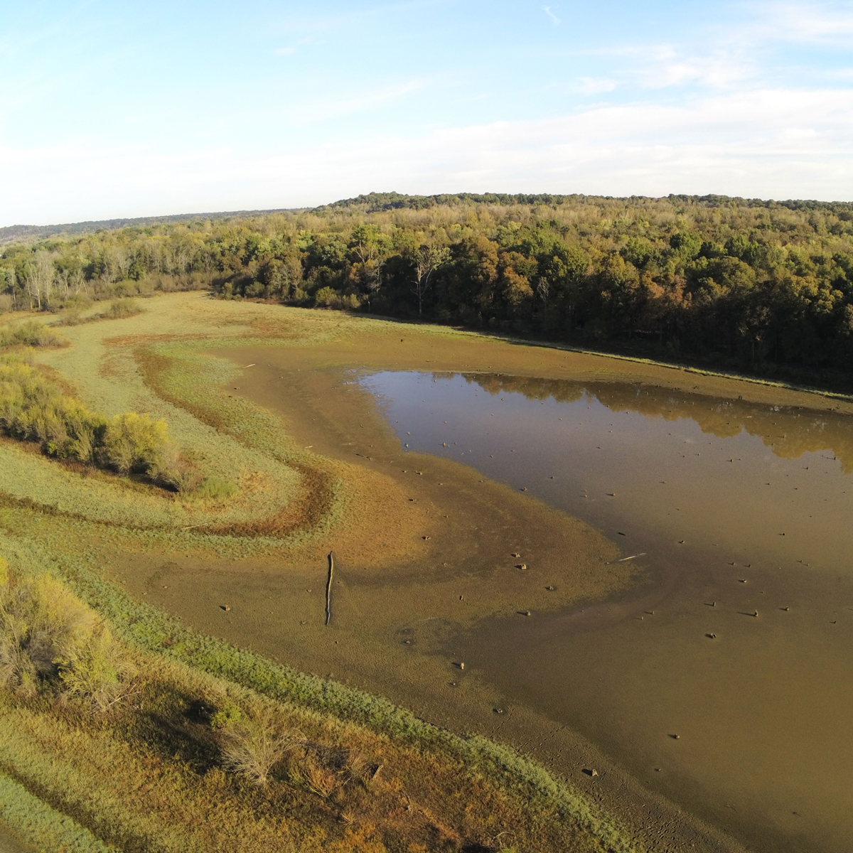
The project uses natural processes to maximum benefits, thereby reducing demands on limited resources, minimizing the footprint of the project, and enhancing the quality of project benefits. Economic benefits are being realized as the enlarging island has reduced the overall cross-sectional area of the river, increasing the river’s flow through the navigation channel to velocities that were sufficient to reduce shoaling and maintenance dredging requirements. Costs were lower than the conventional approach because all other placement alternatives required additional equipment and land-rights to convey dredged material over long distances. Signs of human activity were also noted on the island, as the presence of shotgun shells signified that the island was being used for hunting. Intentionally aligning natural processes in the river with engineering processes via strategically mounding dredged material is realizing tangible ecological, social, and economic benefits. To this day, the island continues to provide multiple benefits and offers a means of beneficially using dredged sediments from the adjacent federal navigation channel to sustain and grow the island over time (Figure 4).
Investigations quantifying the multiple environmental and other benefits of using dredged material to create such riverine islands will provide a more complete understanding of the formation of the island so this concept can be integrated into other dredging projects in coastal Louisiana and elsewhere, thereby providing substantial ecological, social, and economic benefits as part of ongoing USACE maintenance dredging activities. To this end, the USACE is currently applying these practices and lessons learned at other locations along the Louisiana gulf coast and within the Philadelphia District, among others.
References
Foran, C.M., Burks-Copes, K.A., Berkowitz, J., Corbino, J., and Suedel, B.C. 2018. Quantifying Wildlife and Navigation Benefits of a Dredging Beneficial Use Project in the Lower Atchafalaya River: A Demonstration of Engineering With Nature®. Integr. Environ. Assess. Manage. 14(6):759-768. DOI: 10.1002/ieam.4084.
Berkowitz, J.F., Green, L., VanZomeren, C.M. and White, J.R. 2016. Evaluating soil properties and potential nitrate removal in wetlands created using an Engineering With Nature based dredged material placement technique. Ecological Engineering. 97:381-388.